![](/images/other/stat-length.png)
20211028-Tostes
doudet
Gebruiker
![Lengte](/images/other/stat-length.png)
Lengte
13,4 km
![Max. hoogte](https://static1.geolcdn.com/siteimages/upload/files/1508320355ic_sort_altitude_max_24dp.png)
Max. hoogte
147 m
![Positief hoogteverschil](https://static1.geolcdn.com/siteimages/upload/files/1508320355ic_sort_den_pos_24dp.png)
Positief hoogteverschil
213 m
![Km-Effort](/images/other/stat-length.png)
Km-Effort
16,2 km
![Min. hoogte](https://static1.geolcdn.com/siteimages/upload/files/1508320355ic_sort_altitude_min_24dp.png)
Min. hoogte
66 m
![Negatief hoogteverschil](https://static1.geolcdn.com/siteimages/upload/files/1508320355ic_sort_den_neg_24dp.png)
Negatief hoogteverschil
214 m
![Boucle](https://static1.geolcdn.com/siteimages/upload/files/16400158638029165_repeat_loop_refresh_sync_direction_icon.png)
Boucle
Ja
Datum van aanmaak :
2021-10-28 12:07:37.172
Laatste wijziging :
2021-10-29 06:50:26.489
![Stappen](https://static1.geolcdn.com/sitytour/trail-icons/101.png)
3h28
Moeilijkheid : Medium
![Scan deze QR-code om de tocht te openen in de SityTrail-applicatie](https://capi.geolives.com/qq0zvz2zws4bq2lad0pu/sitytour/trails/2985896/qr.png?size=200)
Gratisgps-wandelapplicatie
Over ons
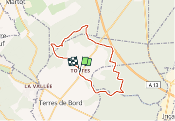
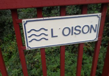
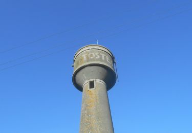
Tocht Stappen van 13,4 km beschikbaar op Normandië, Eure, Terres de Bord. Deze tocht wordt voorgesteld door doudet.
Beschrijving
Boucle A-R au départ d la salle des fêtes de Tostes
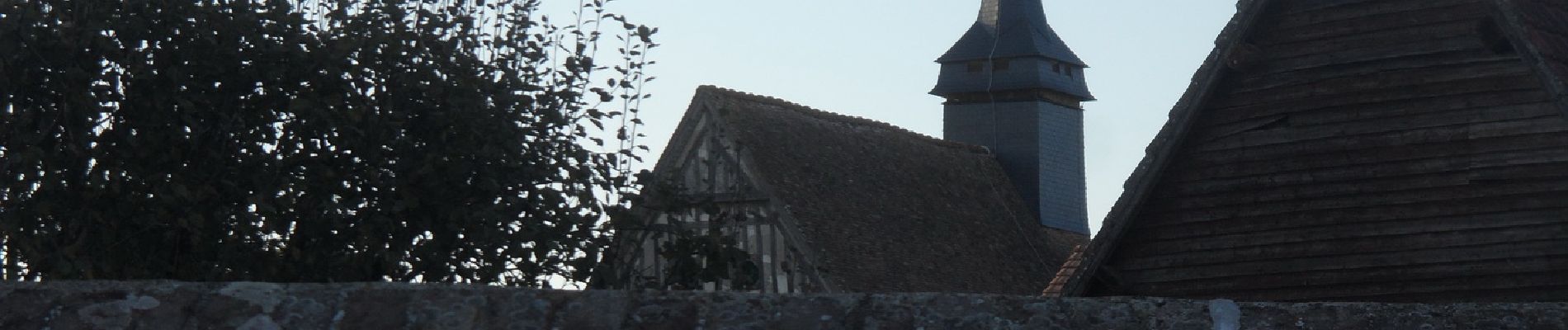
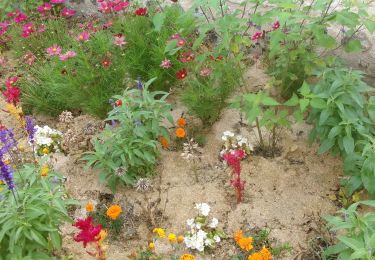
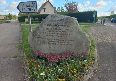
Plaatsbepaling
Land:
France
Regio :
Normandië
Departement/Provincie :
Eure
Gemeente :
Terres de Bord
Locatie:
Tostes
Vertrek:(Dec)
Vertrek:(UTM)
362581 ; 5458009 (31U) N.
Opmerkingen
Wandeltochten in de omgeving
![Tocht Trail Les Damps - 20190820_135035 - Photo](https://media.geolcdn.com/t/375/260/ext.jpg?maxdim=2&url=https%3A%2F%2Fstatic1.geolcdn.com%2Fsiteimages%2Fupload%2Ffiles%2F1524743154running.jpg)
![Trail Trail](https://static1.geolcdn.com/sitytour/trail-icons/104.png)
20190820_135035
Trail
Heel gemakkelijk
(1)
Les Damps,
Normandië,
Eure,
France
![](/images/other/stat-length.png)
10,9 km | 12,5 km-effort
Onbekend
![](https://static1.geolcdn.com/siteimages/upload/files/16400158638029165_repeat_loop_refresh_sync_direction_icon.png)
Ja
![Stappen Stappen](https://static1.geolcdn.com/sitytour/trail-icons/101.png)
20240903-Martot -Cool
Stappen
Gemakkelijk
Martot,
Normandië,
Eure,
France
![](/images/other/stat-length.png)
7,5 km | 8,4 km-effort
2h 9min
![](https://static1.geolcdn.com/siteimages/upload/files/16400158638029165_repeat_loop_refresh_sync_direction_icon.png)
Ja
![Tocht Stappen Saint-Pierre-lès-Elbeuf - st pierre les elbeuf - Photo](https://media.geolcdn.com/t/375/260/d384aabd-24bc-4d08-a404-8e52f9d65d71.jpg&format=jpg&maxdim=2)
![Stappen Stappen](https://static1.geolcdn.com/sitytour/trail-icons/101.png)
st pierre les elbeuf
Stappen
Medium
Saint-Pierre-lès-Elbeuf,
Normandië,
Seine-Maritime,
France
![](/images/other/stat-length.png)
8,8 km | 9,5 km-effort
1h 48min
![](https://static1.geolcdn.com/siteimages/upload/files/16400158638029165_repeat_loop_refresh_sync_direction_icon.png)
Ja
![Stappen Stappen](https://static1.geolcdn.com/sitytour/trail-icons/101.png)
20240402-louviers
Stappen
Gemakkelijk
Louviers,
Normandië,
Eure,
France
![](/images/other/stat-length.png)
7,8 km | 9,7 km-effort
2h 14min
![](https://static1.geolcdn.com/siteimages/upload/files/16400158638029165_repeat_loop_refresh_sync_direction_icon.png)
Ja
![Stappen Stappen](https://static1.geolcdn.com/sitytour/trail-icons/101.png)
20240224-La Haye Malherbe
Stappen
Medium
La Haye-Malherbe,
Normandië,
Eure,
France
![](/images/other/stat-length.png)
10,2 km | 11,7 km-effort
2h 30min
![](https://static1.geolcdn.com/siteimages/upload/files/16400158638029165_repeat_loop_refresh_sync_direction_icon.png)
Neen
![Stappen Stappen](https://static1.geolcdn.com/sitytour/trail-icons/101.png)
20240206-St Pierre les Elbeuf Cool
Stappen
Gemakkelijk
Saint-Pierre-lès-Elbeuf,
Normandië,
Seine-Maritime,
France
![](/images/other/stat-length.png)
8,6 km | 9,7 km-effort
2h 8min
![](https://static1.geolcdn.com/siteimages/upload/files/16400158638029165_repeat_loop_refresh_sync_direction_icon.png)
Ja
![Tocht Stappen Les Damps - 20231212-Les Damps - Photo](https://media.geolcdn.com/t/375/260/9b98702f-b952-4d47-95e5-e5dc435553fd.jpg&format=jpg&maxdim=2)
![Stappen Stappen](https://static1.geolcdn.com/sitytour/trail-icons/101.png)
20231212-Les Damps
Stappen
Medium
Les Damps,
Normandië,
Eure,
France
![](/images/other/stat-length.png)
9,5 km | 11,1 km-effort
2h 39min
![](https://static1.geolcdn.com/siteimages/upload/files/16400158638029165_repeat_loop_refresh_sync_direction_icon.png)
Ja
![Stappen Stappen](https://static1.geolcdn.com/sitytour/trail-icons/101.png)
20231114-St Pierre les Elbeuf
Stappen
Gemakkelijk
Saint-Pierre-lès-Elbeuf,
Normandië,
Seine-Maritime,
France
![](/images/other/stat-length.png)
7,3 km | 7,9 km-effort
1h 54min
![](https://static1.geolcdn.com/siteimages/upload/files/16400158638029165_repeat_loop_refresh_sync_direction_icon.png)
Ja
![Stappen Stappen](https://static1.geolcdn.com/sitytour/trail-icons/101.png)
20231010-Tostes
Stappen
Medium
Terres de Bord,
Normandië,
Eure,
France
![](/images/other/stat-length.png)
12,8 km | 15,1 km-effort
3h 22min
![](https://static1.geolcdn.com/siteimages/upload/files/16400158638029165_repeat_loop_refresh_sync_direction_icon.png)
Ja